


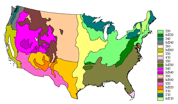
Ecoregion "Divisions" represent regional climatic types within Domains. Divisions are differentiated based on precipitation levels and patterns, temperature, and vegetational affinities. Divisions range in size from three thousand square miles (7,800 sq km) to tens of thousands of square miles (multiples of 26,000 sq km). There are 25 Divisions, of which 11 are identified as Mountain Provinces.
Ecoregion Divisions are described by patterns of precipitation, temperature, climatic seasons, severe weather, soils, and vegetation cover.
See the "Ecoregions Introduction" for information about Domains, Divisions, Provinces and Sections.
210 Warm Continental Division
South of the eastern area of the subarctic climate, in the region between lat. 40 and 55 N. and from the continental interior to the east coast, lies the humid warm-summer continental climate. Located squarely between the source regions of polar continental air masses to the north and maritime or continental tropical air masses to the south, it is subject to strong seasonal contrasts in temperature as these air masses push back and forth across the continent.
In the Koppen-Trewartha system, this area is designated as Dcb, described as a cold, snowy winter climate with a warm summer (see Appendix 2, climate diagram for Iron Mountain, Michigan). The Dcb climate has 4 to 7 months when temperatures exceed 50F (10C), with no dry season. The average temperature during the coldest month is below 32F (0C). The warm summer signified by the symbol b has an average temperature during its hottest month that never exceeds 72F (22C). Precipitation is ample all year, but is substantially greater during the summer.
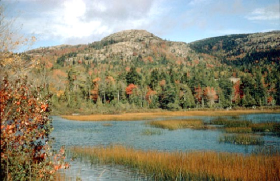
Needleleaf and mixed needleleaf-deciduous forest grows throughout the colder northern parts of the humid continental climate zone, extending into the mountain regions of the Adirondacks and northern New England. Here soils are Spodosols with a low supply of bases and a horizon in which organic matter, iron, and aluminum have accumulated. They are strongly leached, but have an upper layer of humus. Cool temperatures inhibit bacterial activity that would destroy this organic matter in tropical regions. Soils are deficient in calcium, potassium, and magnesium, and are generally acid. Thus, they are poorly suited to crop production, even though adequate rainfall is generally assured; but conifers thrive in them.
The Warm Continental Division is subdivided into three Provinces:212 Laurentian Mixed Forest Province
M210 Warm Continental Division - Mountain Provinces
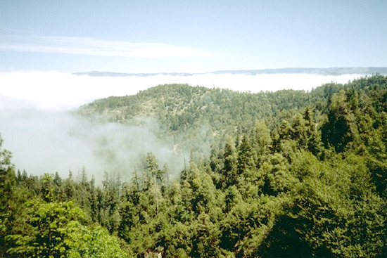
M212 Adirondack-New England Mixed Forest--Coniferous Forest--Alpine Meadow Province
See Ecoregions 3: Provinces for details about those and other Ecoregion Provinces.
220 Hot Continental Division

South of the warm continental climate lies another division in the Humid Temperate Domain, one with hot summers and cool winters (see Appendix 2, climate diagram for Fort Wayne, Indiana). The boundary between the two is the isotherm of 72F (22C) for the warmest month. In the warmer sections of the Hot Continental Division, the frost-free or growing season continues for 5 to 6 months, in the colder sections only 3 to 5 months. Snow cover is deeper and lasts longer in the northerly areas.
In the Koppen-Trewartha system, areas in this division are classified as Dca (a signifies hot summer). We include in the Hot Continental Division the northern part of Koppen's Cf climate region in the eastern United States. Koppen uses as boundary between C and D climates the isotherm of 26.6F (-3C) for the coldest month. For example, Koppen places New Haven, Connecticut, and Cleveland, Ohio, in the same climatic region as New Orleans, Louisiana, and Tampa, Florida, despite obvious sharp differences in January mean temperatures, soil groups, and natural vegetation between these northern and southern zones. Trewartha (1968) redefined the boundary between C and D climates as the isotherm of 32F (0C) for the coldest month, thereby pushing the climate boundary south to a line extending roughly from St. Louis to New York City. Trewartha's boundary is adopted here in distinguishing between humid continental and humid subtropical climates.
Vegetation in this climate division is winter deciduous forest, dominated by tall broadleaf trees that provide a continuous dense canopy in summer, but shed their leaves completely in winter. Lower layers of small trees and shrubs are weakly developed. In spring, a luxuriant ground cover of herbs quickly develops, but is greatly reduced after trees reach full foliage and shade the ground.
Soils are chiefly Inceptisols, Ultisols, and Alfisols, rich in humus and moderately leached, with a distinct light-colored leached zone under the dark upper layer. The Ultisols have a low supply of bases and a horizon in which clay has accumulated. Where topography is favorable, diversified farming and dairying are the most successful agricultural practices.
Rainfall decreases with distance from the ocean. Therefore, this division is subdivided into moist oceanic and dry continental provinces.
The Hot Continental Division is subdivided into five Provinces:221 Eastern Broadleaf Forest (Oceanic) Province
222 Eastern Broadleaf Forest (Continental) Province
M220 Hot Continental Division - Mountain Provinces
M221 Central Appalachian Broadleaf Forest--Coniferous Forest--Meadow Province
M222 Ozark Broadleaf Forest--Meadow Province
See Ecoregions 3: Provinces for details about those and other Ecoregion Provinces.
230 Subtropical Division
The humid subtropical climate, marked by high humidity (especially in summer) and the absence of really cold winters, prevails in Southern Atlantic and Gulf Coast States.
In the Koppen-Trewartha system, this area lies within the Cf climate, described as temperate and rainy with hot summers (see Appendix 2, climate diagram for Atlanta, Georgia). The Cf climate has no dry season; even the driest summer month receives at least 1.2 in (30 mm) of rain. The average temperature of the warmest summer month is above 72F (22C). Rainfall is ample all year, but is markedly greater during summer. Thunderstorms, whether of thermal, squall-line, or cold-front origin, are especially frequent in summer. Tropical cyclones and hurricanes strike the coastal area occasionally, always bringing very heavy rains. Winter precipitation, some in the form of snow, is of the frontal type. Temperatures are moderately wide in range and comparable to those in tropical deserts, but without the extreme heat of a desert summer.
Soils in the moister, warmer parts of the humid subtropical regions are strongly leached Ultisols related to those of the humid tropical and equatorial climates. Rich in oxides of both iron and aluminum, these soils are poor in many of the plant nutrients essential for successful agricultural production.
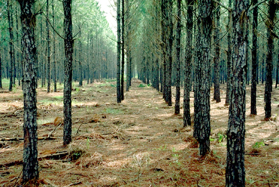
Forest provides the typical vegetation throughout most of this division. Much of the sandy coastal region of the Southeastern United States is covered by second-growth forests of longleaf, loblolly, and slash pines. Inland areas have deciduous forest.
The Subtropical Division is subdivided into five Provinces:231 Southeastern Mixed Forest Province
232 Outer Coastal Plain Mixed Forest Province
234 Lower Mississippi Riverine Forest Province
M230 Subtropical Division - Mountain Provinces
M231 Ouachita Mixed Forest--Meadow Province
See Ecoregions 3: Provinces for details about those and other Ecoregion Provinces.
240 Marine Division
Situated on the Pacific coast between latitudes 40 and 60 N. is a zone that receives abundant rainfall from maritime polar air masses and has a rather narrow range of temperatures because it borders on the ocean.
Trewartha (1968) classifies the marine west coast climate as Do--temperate and rainy, with warm summers. The average temperature of the warmest month is below 72F (22C), but at least 4 months per year have an average temperature of 50F (10C). The average temperature during the coldest month of the year is above 32F (0C). Precipitation is abundant throughout the year, but is markedly reduced during summer (see Appendix 2, climate diagram for Astoria, Oregon). Although total rainfall is not great by tropical standards, the cooler air temperatures here reduce evaporation and produce a very damp, humid climate with much cloud cover. Mild winters and relatively cool summers are typical. Coastal mountain ranges influence precipitation markedly in these middle latitudes. The mountainous coasts of British Columbia and Alaska annually receive 60 to 80 in (1,530 to 2,040 mm) of precipitation and more. Heavy precipitation greatly contributed to the development of fiords along the coast: heavy snows during the glacial period fed vigorous valley glaciers that descended to the sea, scouring deep troughs that reach at their lower ends below sea level.
Natural vegetation in the Marine Division is needleleaf forest. In the coastal ranges of the Pacific Northwest, Douglas-fir, redcedar, and spruce grow to magnificent heights, forming some of the densest of all coniferous forests with some of the world's largest trees.
Soils are strongly leached, acid Inceptisols and Ultisols. Due to the region's cool temperatures, bacterial activity is slower than in the warm tropics, so vegetative matter is not consumed and forms a heavy surface deposit. Organic acids from decomposing vegetation react with soil compounds, removing such bases as calcium, sodium, and potassium.
The Marine Division is subdivided into three Provinces:242 Pacific Lowland Mixed Forest Province
M240 Marine Division - Mountain Provinces
M242 Cascade Mixed Forest--Coniferous Forest--Alpine Meadow Province
See Ecoregions 3: Provinces for details about those and other Ecoregion Provinces.
250 Prairie Division

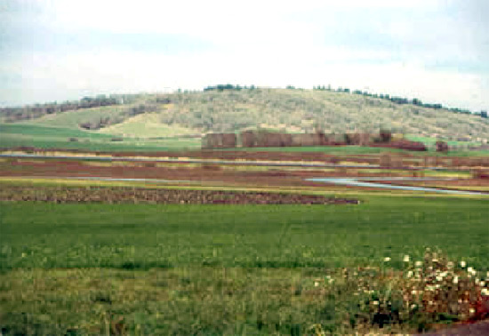
Prairies are typically associated with continental, mid-latitude climates that are designated as subhumid. Precipitation in these climates ranges from 20 to 40 in (510 to 1,020 mm) per year, and is almost entirely offset by evapotranspiration (see Appendix 2, climate diagram for Fargo, North Dakota). In summer, air and soil temperatures are high; soil moisture in the uplands is inadequate for tree growth, and deeper sources of water are beyond the reach of tree roots. Prairie forms a broad belt extending from Texas northward to southern Alberta and Saskatchewan. Forest and prairie mix in a transitional belt on the eastern border of the division.
The prairie climate is not designated as a separate variety in the Koppen-Trewartha system. Geographers' recognition of the prairie climate (Thornthwaite 1931, Borchert 1950) has been incorporated into the system presented here. Prairies lie on the arid western side of the humid continental climate, extending into the subtropical climate at lower latitudes. Temperature characteristics correspond to those of adjacent humid climates, forming the basis for two types of prairies: temperate and subtropical.
Prairie vegetation is dominated by tall grasses associated with subdominant broad-leaved herbs. Trees and shrubs are almost totally absent, but a few may grow as woodland patches in valleys and other depressions. Grasses are deeply rooted and form a continuous cover. They flower in spring and early summer, with forbs appearing in late summer. In the tall-grass prairie of Iowa, for example, typical grasses are big bluestem and little bluestem; a typical forb is black-eyed Susan.
Because there is less rainfall in the grasslands than in forest, there is also less leaching of the soil. The pedogenic process associated with prairie vegetation is calcification, as carbonates accumulate in lower soil layers. Soils of the prairies are Mollisols, which have black, friable, organic surface horizons and a high content of bases. Grass roots deeply penetrate these soils. Bases brought to the surface by plant growth are released on the surface and restored to the soil, perpetuating fertility. These soils are the most productive of the great soil groups.
The Prairie Division is subdivided into two Provinces:251 Prairie Parkland (Temperate) Province
255 Prairie Parkland (Subtropical) Province
See Ecoregions 3: Provinces for details about those and other Ecoregion Provinces.
260 Mediterranean Division
Situated on the Pacific coast between latitudes 30 and 45 N. is a zone subject to alternate wet and dry seasons, the transition zone between the dry west coast desert and the wet west coast.
Trewartha (1968) classifies the climate of these lands as Cs, signifying a temperate rainy climate with the dry, hot summers indicated by the symbol s (see Appendix 2, climate diagram for Pasadena, California). The combination of wet winters with dry summers is unique among climate types and produces a distinctive natural vegetation of hardleaved evergreen trees and shrubs called sclerophyll forest. Various forms of sclerophyll woodland and scrub are also typical. Trees and shrubs must withstand the severe summer drought--2 to 4 rainless months--and severe evaporation.
Soils of this Mediterranean climate are not susceptible to simple classification. Alfisols and Mollisols typical of semiarid climates are generally found.
The Mediterranean Division is subdivided into six Provinces:261 California Coastal Chaparral Forest and Shrub Province
262 California Dry Steppe Province
263 California Coastal Steppe, Mixed Forest, and Redwood Forest Province
M260 Mediterranean Division - Mountain Provinces
M261 Sierran Steppe--Mixed Forest--Coniferous Forest--Alpine Meadow Province
M262 California Coastal Range Open Woodland--Shrub--Coniferous Forest--Meadow Province
See Ecoregions 3: Provinces for details about those and other Ecoregion Provinces.
310 Tropical / Subtropical Steppe Division
Tropical steppes border the tropical deserts on both the north and south, and in places on the east as well. Locally because of altitude, plateaus and high plains within what would otherwise be desert have a semiarid steppe climate. Steppes on the poleward fringes of the tropical deserts grade into the Mediterranean climate in many places. In the United States, they are cut off from the Mediterranean climate by coastal mountains that allow tropical deserts to extend farther north.
Trewartha (1968) classifies the climate of tropical/subtropical steppes as BSh, indicating a hot semiarid climate where potential evaporation exceeds precipitation, and where all months have temperatures above 32F (0C--see Appendix 2, climate diagram for Abilene, Texas).
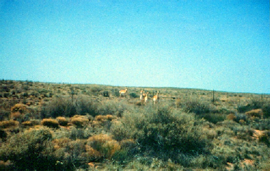
Steppes typically are grasslands of short grasses and other herbs, and with locally developed shrub- and woodland. On the Colorado Plateau, for example, there is pinyon-juniper woodland. To the east, in Texas, the grasslands grade into savanna woodland or semideserts composed of xerophytic shrubs and trees, and the climate becomes semiarid-subtropical. Cactus plants are present in some places. These areas are able to support limited grazing, but are not generally moist enough for crop cultivation without irrigation. Soils are commonly Mollisols and Aridisols, containing some humus.
The Tropical / Subtropical Steppe Division is subdivided into five Provinces:311 Great Plains Steppe and Shrub Province
313 Colorado Plateau Semidesert Province
315 Southwest Plateau and Plains Dry Steppe and Shrub Province
M310 Tropical/Subtropical Steppe Division - Mountain Provinces
M313 Arizona-New Mexico Mountains Semidesert-Open Woodland--Coniferous Forest--Alpine Meadow Province
See Ecoregions 3: Provinces for details about those and other Ecoregion Provinces.
320 Tropical / Subtropical Desert Division
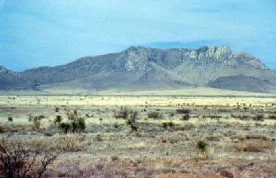
South of the Arizona-New Mexico Mountains are the continental desert climates, which have not only extreme aridity, but also extremely high air and soil temperatures. Direct sun radiation is very strong, as is outgoing radiation at night, causing extreme variations between day and night temperatures and a rare nocturnal frost. Annual precipitation is less than 8 in (200 mm), and less than 4 in (100 mm) in extreme deserts (see Appendix 2, climate diagram for Brawley, California). These areas have climates that Trewartha (1968) calls BWh.
The region is characterized by dry-desert vegetation, a class of xerophytic plants that are widely dispersed and provide negligible ground cover. In dry periods, visible vegetation is limited to small hard-leaved or spiny shrubs, cacti, or hard grasses. Many species of small annuals may be present, but they appear only after the rare but heavy rains have saturated the soil.
In the Mojave-Sonoran Deserts (American Desert), plants are often so large that some places have a near-woodland appearance. Well known are the treelike saguaro cactus, the prickly pear cactus, the ocotillo, creosote bush, and smoke tree. But much of the desert of the Southwestern United States is in fact scrub, thorn scrub, savanna, or steppe grassland. Parts of this region have no visible plants; they are made up of shifting sand dunes or almost sterile salt flats.
A dominant pedogenic process is salinization, which produces areas of salt crust where only salt-loving (halophytic) plants can survive. Calcification is conspicuous on well-drained uplands, where encrustations and deposits of calcium carbonate (caliche) are common. Humus is lacking and soils are mostly Aridisols and dry Entisols.
The Tropical / Subtropical Desert Division is subdivided into two Provinces:321 Chihuahuan Semidesert Province
322 American Semidesert and Desert Province
See Ecoregions 3: Provinces for details about those and other Ecoregion Provinces.
330 Temperate Steppe Division
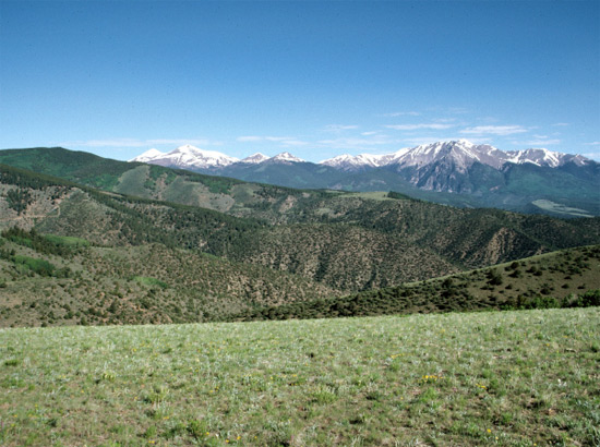
Temperate steppes are areas with a semiarid continental climatic regime in which, despite maximum summer rainfall, evaporation usually exceeds precipitation. Trewartha (1968) classifies the climate as BSk; the letter k signifies a cool climate with at least 1 month of average temperatures below 32F (0C). Winters are cold and dry, summers warm to hot (see Appendix B, climate diagram for Colorado Springs, Colorado). The vegetation is steppe, sometimes called shortgrass prairie, and semidesert. Typical steppe vegetation consists of numerous species of short grasses that usually grow in sparsely distributed bunches. Scattered shrubs and low trees sometimes grow in the steppe; all gradations of cover are present, from semidesert to woodland. Because ground cover is generally sparse, much soil is exposed. Many species of grasses and other herbs occur. Buffalo grass is typical of the American steppe; other typical plants are the sunflower and locoweed.
The semidesert cover is a xerophytic shrub vegetation accompanied by a poorly developed herbaceous layer. Trees are generally absent. An example of semidesert cover is the sagebrush vegetation of the middle and southern Rocky Mountain region and the Colorado Plateau.
In this climatic regime, the dominant pedogenic process is calcification, with salinization on poorly drained sites. Soils contain a large excess of precipitated calcium carbonate and are very rich in bases. Mollisols are typical in steppe lands. The soils of the semidesert shrub are Aridisols with little organic content, pedogenic and (occasionally) clay horizons, and (in some places) accumulations of various salts. Humus content is small because the vegetation is so sparse.
The Temperate Steppe Division is subdivided into two Provinces:331 Great Plains-Palouse Dry Steppe Province
332 Great Plains Steppe Province
See Ecoregions 3: Provinces for details about those and other Ecoregion Provinces.
340 Temperate Desert Division
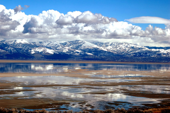
Temperate deserts of continental regions have low rainfall and strong temperature contrasts between summer and winter. In the intermountain region of the Western United States between the Pacific coast and Rocky Mountains, the temperate desert has characteristics of a sagebrush (Artemisia) semidesert, with a very pronounced drought season and a short humid season. Most precipitation falls in winter, despite a peak in May (see Appendix 2, climate diagram for Salt Lake City, Utah). Aridity increases markedly in the rain shadow of the Pacific mountain ranges. Even at intermediate elevations, winters are long and cold, with temperatures falling below 32F (0C).
Under the Koppen-Trewartha system, this is true desert, BWk. The letter k signifies that at least 1 month has an average temperature below 32F (0C). These deserts differ from those at lower latitudes chiefly in their far greater annual temperature range and much lower winter temperatures. Unlike the dry climates of the tropics, dry climates in the middle latitudes receive part of their precipitation as snow.
Temperate desert climates support the sparse xerophytic shrub vegetation typical of semidesert. One example is the sagebrush vegetation of the Great Basin and northern Colorado Plateau. Recently, semidesert shrub vegetation seems to have invaded wide areas of the Western United States that were formerly steppe grasslands, due to overgrazing and trampling by livestock. Soils of the temperate desert are Aridisols low in humus and high in calcium carbonate. Poorly drained areas develop saline soils, and dry lake beds are covered with salt deposits.
The Temperate Desert Division is subdivided into five Provinces:M331 Southern Rocky Mountain Steppe--Open Woodland--Coniferous Forest--Alpine Meadow Province
M340 Temperate Desert Division - Mountain Provinces
M341 Nevada-Utah Mountains Semidesert--Coniferous Forest--Alpine Meadow Province
341 Intermountain Semidesert and Desert Province
342 Intermountain Semidesert Province
See Ecoregions 3: Provinces for details about those and other Ecoregion Provinces.
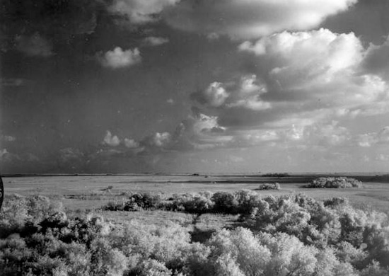
410 Savanna Division
The latitude belt between 10 and 30 N. is intermediate between the equator and middle latitudes. This produces the tropical wet-dry savanna climate, which has a wet season controlled by moist, warm maritime tropical air masses at times of high sun, and a dry season controlled by continental tropical air masses at times of low sun (see Appendix 2, climate diagram for Key West, Florida). Trewartha (1968) classifies the tropical wet-dry climate as Aw, with the letter w signifying a dry winter.
Alternation of wet and dry seasons results in the growth of a distinctive vegetation known generally as tropical savanna. It is characterized by open expanses of tall grasses interspersed with hardy, drought-resistant shrubs and trees. Some areas have savanna woodland, monsoon forest, thornbush, and tropical scrub. In the dry season, grasses wither into straw and many tree species shed their leaves. Other trees and shrubs have thorns and small or hard, leathery leaves that resist loss of water.
Soils are mostly Histosols and Inceptisols. Heavy rainfall and high temperatures result in heavy leaching. Streamflow in these regions is subject to strong seasonal fluctuations, in striking contrast to the constant streamflow typical of rainforest climates. In the rainy season, extensive low-lying areas are submerged; in the dry season, streamflow dissipates, exposing channel bottoms of sand and gravel as mud flats dry out.
In North America, the Savanna Province Division is found in southern Florida, where habitats and fauna are strongly influenced by fluctuating water levels. Large numbers of birds are especially characteristic.
The Savanna Division is subdivided into three Provinces:411 Everglades Province
M410 Savanna Division - Mountain Provinces
M411 Puerto Rico Province
See Ecoregions 3: Provinces for details about those and other Ecoregion Provinces.
Mountain Segments of Divisions
Mountains exhibiting altitudinal zonation and the climatic regime of the adjacent lowlands are distinguished according to the character of zonation. Please see the specific provinces for the Division.
See Ecoregions 3: Provinces for details about those and other Ecoregion Provinces.
Copyright © 1993-2026 World Trade Press. All rights reserved.