

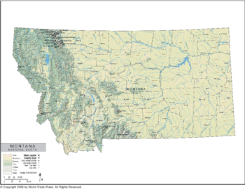
Natural Earth Map of Montana
| Dimensions: | 7.5 x 10.0 in (19.1 x 25.4cm) |
|---|---|
| Publisher or Printer: | World Trade Press |
| Published in: | Traverse City, MI |
| Year Published: | 2020 |
A choropleth thematic map of Montana using shading to indicate natural earth features, including desert, savannah, forest, highland and tundra. Also shows county boundaries, county seat, major river systems and major lakes.
Features on This Map:
- Legend: YES
- County Borders: YES
- County Names: YES
- Lakes Fill: YES
- Coastline: YES
- County Seat Location Icon: YES
- County Seat Location Name: YES
- Major City Located by Icons: YES
- Major City Names: YES
- Major River Systems: YES
- Secondary River Systems: YES
- Major River Names: YES
- Natural Earth Surface Features: YES
- Projection: Lambert Conformal Conic
- Natural Earth Features: Isopleth
View, Print, Download
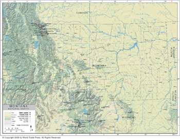
Natural Earth Map of Montana Region
| Dimensions: | 7.5 x 10.0 in (19.1 x 25.4cm) |
|---|---|
| Publisher or Printer: | World Trade Press |
| Published in: | Traverse City, MI |
| Year Published: | 2020 |
A choropleth thematic map of Montana and the surrounding area using shading to indicate natural earth features, including desert, savannah, forest, highland and tundra. Also shows county boundaries, county seat, major river systems and major lakes.
Features on This Map:
- Legend: YES
- County Borders: YES
- County Names: YES
- Lakes Fill: YES
- Coastline: YES
- County Seat Location Icon: YES
- County Seat Location Name: YES
- Major City Located by Icons: YES
- Major City Names: YES
- Major River Systems: YES
- Secondary River Systems: YES
- Major River Names: YES
- Natural Earth Surface Features: YES
- Projection: Lambert Conformal Conic
- Natural Earth Features: Isopleth
View, Print, Download
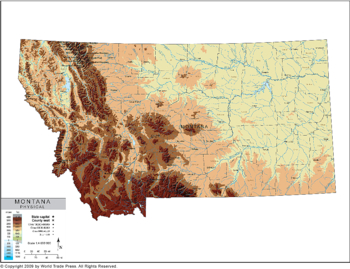
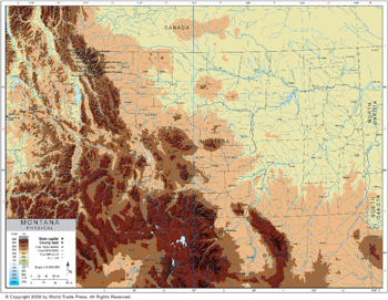
Physical Map of Montana
| Dimensions: | 7.5 x 10.0 in (19.1 x 25.4cm) |
|---|---|
| Publisher or Printer: | World Trade Press |
| Published in: | Traverse City, MI |
| Year Published: | 2020 |
A choropleth thematic map of Montana using shading to indicate elevation from sea level. Also shows county boundaries, county seat, major river systems and major lakes.
Features on This Map:
- Legend: YES
- County Borders: YES
- County Names: YES
- Lakes Fill: YES
- Coastline: YES
- County Seat Location Icon: YES
- County Seat Location Name: YES
- Major City Located by Icons: YES
- Major City Names: YES
- Major River Systems: YES
- Secondary River Systems: YES
- Major River Names: YES
- Color Coded Elevation: YES
- Projection: Lambert Conformal Conic
- Physical Features: Isopleth
View, Print, Download
Physical Map of Montana Region
| Dimensions: | 7.5 x 10.0 in (19.1 x 25.4cm) |
|---|---|
| Publisher or Printer: | World Trade Press |
| Published in: | Traverse City, MI |
| Year Published: | 2020 |
A choropleth thematic map of Montana and the surrounding area using shading to indicate elevation from sea level. Also shows county boundaries, county seat, major river systems and major lakes.
Features on This Map:
- Legend: YES
- County Borders: YES
- County Names: YES
- Lakes Fill: YES
- Coastline: YES
- County Seat Location Icon: YES
- County Seat Location Name: YES
- Major City Located by Icons: YES
- Major City Names: YES
- Major River Systems: YES
- Secondary River Systems: YES
- Major River Names: YES
- Color Coded Elevation: YES
- Projection: Lambert Conformal Conic
- Physical Features: Isopleth
View, Print, Download
Copyright © 1993-2026 World Trade Press. All rights reserved.